This project engages with various ways in which civic society is imagined, represented and built, through its archives, architectures and townscapes.
Using Edinburgh as a case study the project begins with an examination of previous civic surveys of the city by Patrick Geddes in 1910 and Patrick Abercrombie in 1949.
Taking those studies, their methods and their outputs, as a starting point, Visions of Modernity acknowledges the visual language of post war modernism as a further precedent for an engagement with the city as it is found now, in an environment of political uncertainty and technological determinism.
Or at least that was the original plan. With the onset of the Covid pandemic our focus shifted from the possibility of on the ground research to a more fluid, remote approach to gathering data and to the dissemination of results.
Given the ubiquity of Google as a platform, our initial response to this revision of modernity was to explore how Google Street View might be adopted as a data gathering tool. This resonated with our earlier project on the Milton Keynes housing project, Netherfield in which we had drawn upon the methods of Ed Ruscha and his pick-up truck mounted photographic survey of the urban landscape. And a more general inquiry then into what different visual structures Google developed since then that could be useful as an exploratory toolkit, both in terms of engaging with the locked down city and as a methodological toolkit for surveying the city in the 21st century and making useful comparisons with its historical and archival precedents. On this latter point, some of the elements incorporated here are intended as suggestions or proposals for future work that might involve formal partnerships with the record holders of Edinburgh's visual history (rather than a provocation or threat to their copyright - this project is not currently intended for public viewing and the archive images are initially obscured to signify this).
This exploration of the 21st century streets and buildings of Edinburgh also then provides a platform for comparative study of previous survey methods, as developed in the 20th century by Geddes and Abercrombie. The latter, with his focus on data driven techniques in relation to post-war modernisation programmes, also gives us a direct comparison with the broader development, awareness, and analysis of big datasets which Google in part, and Google Street View in particular, has fostered.
We began making initial comparisons between archival images we had to hand and their equivalent rendering in Google maps.
In parallel, and drawing upon our earlier engagement with Netherfield and Ruscha, also explored the possibilities afforded by the same kind of comparisons between the leporello forms which characterise Abercrombie's publications and how these might be replicated and re-rendered through the capture and stitching together of Google Street View imagery.
Organising principles: maps, diptychs, long form scrolls, image galleries, interactive functions.
The project is visual and the results are, as Abercrombie said of his own survey of Edinburgh, intended to be presented in an aesthetic style that encourages the viewer to engage with them. This intention may be somewhat compromised by the constraints of what imagery is accessible and available from online sources. However these sources, Google Street View in particular, have developed a clearly defined visual style, commonly used interface elements and familiar user experiences. They also then bring with them opportunities to build on those established experiences to explore them, perhaps in some places to expose and subvert them.
Together these materials, and the various means by which they are presented, comprise a form of online exhibition. This exhibition then delivers the results of a form of online survey but also offers a reflection on approaches adopted towards its creation.
The intention is to provide a means of reflection on a specific period of Edinburgh’s urban planning history, an exploration of the methods used in the production of that history, and an examination of the diverse means by which the project could be achieved within the constraints of covid-19. In turn this invokes two further objectives: an evaluation of Google’s various mapping lenses as a survey tool and a projection of how this work can be developed in relation to the ongoing planning of Edinburgh’s urban landscape.
Geddes & Abercrombie
Geddes Survey of Edinburgh, text highlights
A randomly displayed collection of short texts drawn from Geddes' introduction, description and rationalisation of his Edinburgh Room exhibition at the 1910 RIBA Town Planning Exhibition. The quotes are selectively taken from the full text of Geddes' paper. They were chosen against two criteria: to reflect the lyricism of Geddes' writing and the visual lexicon he was developing at the time: "Our photographs and maps are arranged so as to show this progress of design and construction, yet also to bring out the reason of their arrest and breakdown, with abandonment of their unused spaces to the contemporary squalor or confusion."
Abercrombie on Geddes (with Princes Street Leporello)
A letter written by Patrick Abercrombie and included in Amelia Defries "The Interpreter Geddes: The man and his gospel". The text demonstrates a direct lineage from Geddes to Abercrombie and the nascent town planning movement in which they were both engaged. Abercrombie's description of the Edinburgh Room at the RIBA Town Planning exhibition in 1910 sheds light both on the textural density of the work that Geddes curated as part of his surveying process, and on the contextual intensity of his performance in the space where it, and he, was installed. There is a sense here of an iconoclastic artist whose conceptual range is challenging, compelling and complicated. The scope of Geddes' influence is further underlined by the references to Lanchester's WW1 "war civic surveys", a line of work that Abercrombie would go on to make his own.
Abercrombie's Civic Survey, facsimile
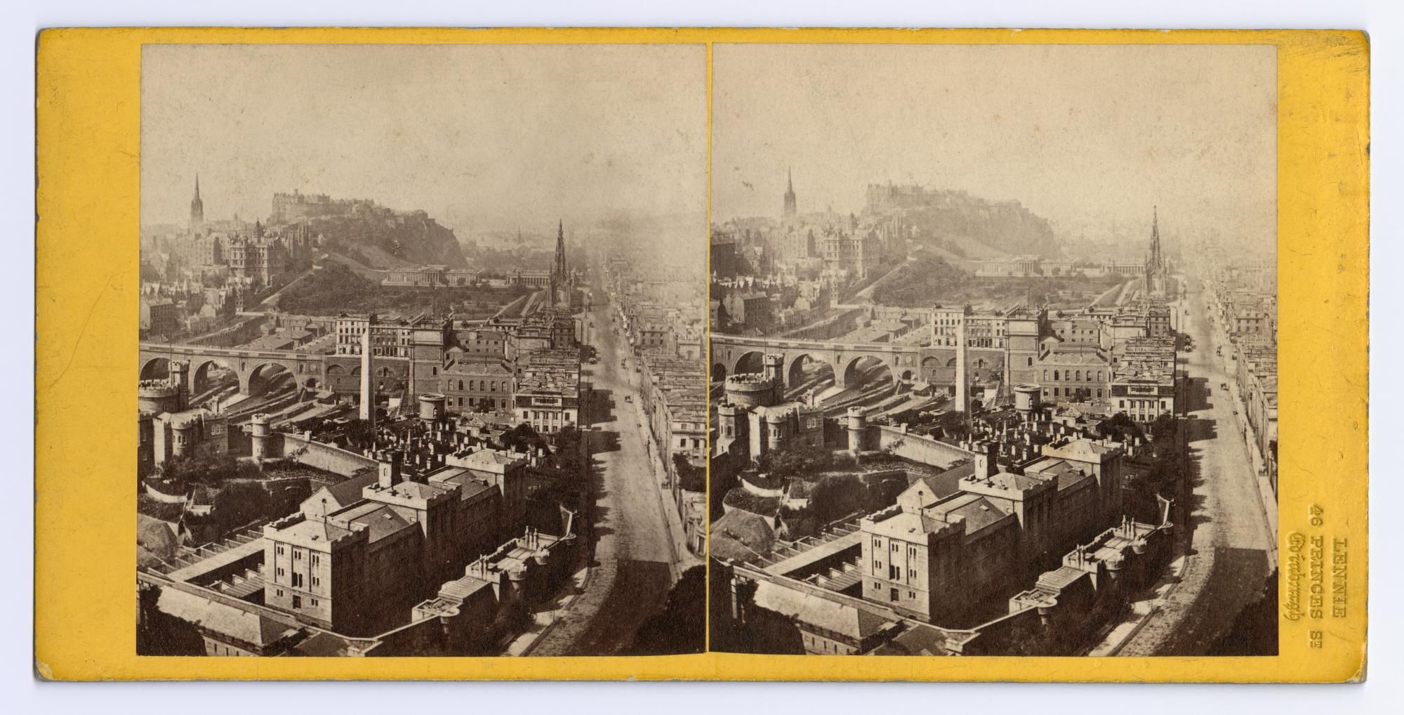
The printed volume of Abercrombie's survey was produced for the town council as part of its response to the 1947 Town and Country Planning Act. The book includes an historical survey of the city with photographs, watercolours and sketches. Foldout maps of the city are overlaid with graphical representations of data gathered during the survey that describe numerous aspects of city life. The six foot long leporello of Water of Leith takes the viewer through a series of watercolour artist impressions of proposed recreational activities between Edinburgh's civic centre Acropolis and the Piraeusian port of Leith.
A Civic Survey & Plan for the City & Royal Burgh of Edinburgh
Patrick Abercrombie and Derek Plumstead
Edinburgh, Oliver and Boyd
1949. 36 x 28 cms, xvi, 115 pp
LIV plates outside the text
XLVI folded maps
Thens & Nows
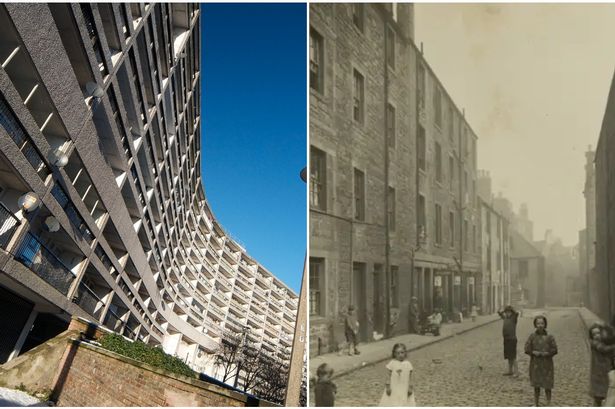
Old Dean Bridge, then and now
|
The CIVICSCOPE includes a number of explorations of "then and now" genre photographs - a convenient and conventional visual comparison tool that often serves to generate nostalgic or to sate curious local historical inquiry. The left hand image in the Old Dean Bridge diptych is from Abercrombie's Civic Survey: "In the heart of Edinburgh lies one of the old village communities of Dean. This view shows the old arched bridge spanning the Water of Leith which meanders through the village itself. Considerable restoration work is called for in the redevelopment of his village" (PLATE L, between pp.78-79). The right hand image is an embedded Google Street View of the same which, by virtue of its interactive functionality allows the viewer to draw their own comparisons. The diptych form also alludes to the development of stereoscopic photography where the visual fields of left and right are separated and offset as a way of shifting perspectives and introducing imaginary depth, into the viewed image.
|
|
|
Calton Hill Artist View
Abercrombie's artist impression, an aerial view from Calton Hill, alongside the similarly framed Google Earth overview.
Usher Hall Artist View
Abercrombie's artist impression of the urban landscape around Usher Hall, alongside the similarly framed Google Earth overview.
St James architect's model
Abercrombie's architect's model as a miniaturised ideal world, alongside the similarly framed Google Earth overview.
George Square - sketched plan
Abercrombie's sketched outline of the educational quarter, "to be read alongside the existing plan for the University Quarter".
Leith Development
The pullout map from the back of Abercrombie's Civic Survey. Leith as a main target of redevelopment, alongside an aerial rendering from Google.
Leith
An ordnance survey of Leith with an Abercrombie sketch of a projected future of the same area aerial rendering, alongside a rendering from Google.
Abercrombie's Housing Ownership Data
Abercrombie's report comprised numerous exercises in data visualisation whereby maps were overlaid with dense iconographic representations of the research undertaken for the survey. Google overlays in different ways.
Photographic Production & Representation
Laverock housing
Embedded Google Street View distorting through an upward camera angle and an elongated display projection. The default interface controls are thereby constrained to focus on specific elements of the architecture and its surroundings.
Cables Wynd
Google Earth Studio produces a re-rendered version of street and building from inside and out. The building outline becomes a transparent framework through which the world is seen, glimpsed and distorted. The images begin as a guided walk through a virtual environment that can be restructured via the random intervention of the viewer.
Brutal Edinburgh I & II
A collection of Simon Phipps architectural photography of Edinburgh taken during previous visits. The second collection is a parallel series of images taken by Simon from within the digital city of Google Earth Studio. A comparative production of camera angle and atmosphere and a provocation on the nature of photographic production.
Granton Landmarks
A collection of 4 single buildings with angles constructed in Google StreetView. The adoption of an iconic approach to architectural representation, transposed to Granton via Google with its integrated interface for shifting, zooming and moving away.
Maps & Archive
Archive collections
A collation of archive images into a long horizontal scroll, automatically generated from established sources, fully referenced but not yet with negotiated permission for viewing on the internet, hence their blurred representation here. These images relate to the sites found in the CIVICSCOPE "Mapping Modernism".
National Library of Scotland Maps
Maps, overlaid and sequentially cross fading from the earliest to the most recent version of Leith available online in the NLS geo-referenced digital mapping tool.
An Architectural Practice
Post war through the lens of one prolific practice. Alison and Hutchison...
Mapping modernism
Key elements of the civic infrastructure expressed through the modernist gaze of 20th century architects, one sector at a time.
Landscapes
Geddes' Valley Section
Geddes' schematic of the relationship between the city,the region and the inhabitants. This drawing has a folk lore about it.
The hinterland and the landscape
A long and drawn out view of Edinburgh from across the Firth of Forth.